Thursday, 19 May 2011

The End

Today is my last day in New Zealand. I am quite sad to be leaving, as I have had a great time here. But I am looking forward to coming back to England because the money has run out because I miss my family, my friends, and having some familiarity.

What are the things I will miss?
  • The coffee
  • The sushi
  • The super-cheap meals out (as long as you go for Asian food and not European)
  • The relaxed lifestyle
  • The scenery
  • The really cool things that result from tectonic activity (hot springs etc)


What are the things I won't miss?
  • A pint of milk costing a million pounds
  • Having to wait for the green man for ages because I can't work out the traffic light sequences
  • Hills
  • The very small shorts that men have a habit of wearing
  • The phrase 'Sweet as, bro'
  • The really rubbish things that result from tectonic activity (earthquakes etc)

I fly out tomorrow at 5pm, and arrive on Sunday at 12:30pm, so expect film reviews soon. I can't guarantee if they'll be witty or bumbling - sleep deprivation has the potential to go either way really. Half of me wants to see if I can beat my personal best of 10 films from the way over here, but the other half wants to take advantage of the free gin to induce sleep during the flight.

To finish up, here is a picture of me with a bowl of coffee:


And yes, that is God in the background. He popped in for a cuppa, because the coffee there is...heavenly (see what I did there?).

Sunday, 15 May 2011

Dolphin Video

As promised, here is the video of dolphins I took:


Okay, okay, that's not the right video. I don't know how you guessed! But here is the video of the dolphins racing the boat.

It was a bit windy, so to prevent you guys having to put your hands over your ears when listening to noise, I have selected a complementary, mood-setting soundtrack to go with it:


Saturday, 14 May 2011

Lake Tekapo - Big Adventure Day 9 & 10

I'm going to put the remaining two days into the same post because we didn't do much except travel and eat fast food.

In fact, I'll just finish up with a picture of Lake Tekapo that I didn't even take myself because my camera was at the bottom of my bag:


THE END

Wednesday, 11 May 2011

Milford Sound - Big Adventure Day 7 & 8

To my extreme annoyance, I had written the majority of this blog post (taking about an hour and saving every few minutes) when unfortunately the site went down. Now it's back up but all text from the post has lost into the internet ether.

Grrr.

So, if this post is rubbish and boring, blame the internet and not my dazzling wit.

When we woke up on Day 7 of our trip, the clouds had mostly gone, and it was blue sky and sunlight. Here is the view of Queenstown and Lake Wakatipu from our hostel:


We enjoyed a relatively relaxed morning (leaving at 10:30am) and set off for Milford Sound.

Milford Sound is a fjord found in the Fiordland National Park (NZ spell fjord wrong) in the southwest part of the South Island. It quickly became apparent that none of us were actually sure what a fjord was (it is an inlet of water in a valley created by glacial activity).

Thousands of years ago, glaciers covered large parts of the South Island. As they flowed down the mountains they gouged great valleys into the rock. Depending on the type of rock they were moving over, you get different types of valleys - low rolling hills if the rock is soft (as in Doubtful Sound) and steep dramatic cliffs if the rock is hard (as in Milford Sound). There are no remaining glaciers in Fiordland, despite the large mountains and extremely heavy rainfall. Milford Sound is one of the wettest inhabited place in the world, and while there are only two permanent waterfalls there, during the rain hundreds of temporary waterfalls appear. If the wind is also blowing, some of these waterfalls can blow horizontally or upwards.

When Captain James Cook was first sailing round the South Island, he completely missed Milford Sound, thinking the narrow entrance didn't lead to anything. He didn't sail too close to the entrance in case wind conditions prevented him from getting out (this refers to Doubtful Sound, as Cook thought it was doubtful he would ever escape). Milford Sound was omitted from maps for several years, until a seal hunter called John Grono found it on his seal hunting escapades. He named it Milford Haven, after his favourite place in Wales, and it was later renamed Milford Sound.

However, Milford Sound is in fact, not a sound. A sound is a sea-flooded valley created by running water i.e. rivers. The word fjord didn't exist in the English language at the time, but now the name has stuck.

Of course, the Maori have their own legends about Milford Sound. Many years ago a demi-god called Tu-te-raki-whanoa was given the task of shaping the southwest part of the South Island. Singing an ancient karakia (chant) he used his adze (a tool used in woodwork) to carve out the southernmost fjords. However, he wasn't very good at it at first, resulting in the low hills of the southern fjords. As he moved up the island he got better with more practice, and by the time he got to Milford Sound he perfected his work, creating the steep cliffs of Piopiotahi (Milford Sound).

Piopiotahi means 'one piopio', a now extinct bird. This harks back to the legend of Maui, who tried to win immortality for mankind. When he died in the attempt, a piopio was said to have flown to the fjord in mourning.

The drive to Milford Sound is, unfortunately, very long. This is because there is no road to Milford Sound from Queenstown due to mountains, so we had to do a big 'U' shape:


However, this meant we got to see some beautiful scenery, including Lake Te Anau, where we stopped for lunch. Here are a selection:


And here are some ducks:


After approximately five hours of driving (with occasional photo stops), we arrived and got our first look at Milford Sound.


Immediately we could see why it has been judged the world's top travel destination, and been described as the eighth wonder of the world. If you ever want to be reminded how small and insignificant the human race is, I would recommend Milford Sound. The word beautiful is not right; awe-inspiring, breath-taking, phenomenal, the most visually stunning thing you will ever see in your entire life - these are all far more appropriate descriptions.

I can kinda understand how it may lead to some people finding God (though obviously I was more 'this is so cool!' than 'we thank you Lord').

Because it was such a long journey from Queenstown, we had booked an overnight cruise. It was a pretty good deal - $168 (£84) for a nice, clean cabin (with fresh towels, which we were overjoyed to find after seven days of packing wet towels in our suitcases), three course evening meal (with 10 desserts!), enormous breakfast, unlimited refreshments, nature commentary and slideshow, and kayaking at dawn.

This is our boat:


The first part of our trip was a two hour leisurely cruise through the sound, out to the Tasmanian Sea. Throughout this our skipper gave a very informative commentary about the things we were seeing and the history of Milford Sound. We arrived at the Tasmanian Sea in time for the sunset:


Then we went back through the Sound and moored for the night in a place called Harrison's Cove. We had the enormous dinner, had the slideshow, and then were left to our own devices. We couldn't get enough of the sight of the Sound (even though it was dark) so went back out on the deck. We were rewarded by seeing a fur seal (we named him Frank) hunting for food. The fish like the lights of the boat, so the seals like the boat too. We probably watched him chasing fish for over an hour.

Fortunately, Milford Sound is spared from a lot of the unsteadiness of the sea by a ridge of rocks at the mouth of the fjord. This is the remains of the terminal moraine created by the glacier. This meant the waters were very calm and everyone got good nights sleep.

After breakfast (about 8am) we went out on the fjord in kayaks. The sun was just coming up, so we got to paddle around while the Sound became gradually lighter. The water was so clear you could see the bottom despite it being 100m deep in the cove (it gets down to 300m in the main stretch). Because of the hardness of the rock the steep cliffs continue under water, so you can get your kayak right up to the sides and not run aground.

At one point some dolphins came over to see what we were all up to.

After the kayaking it was time for a much needed hot shower and drink as we cruised back to the dock. The journey back to Queenstown was much the same, though with fewer photo stops as the rain had started up a bit. Here is the other side of Lake Wakatipu:


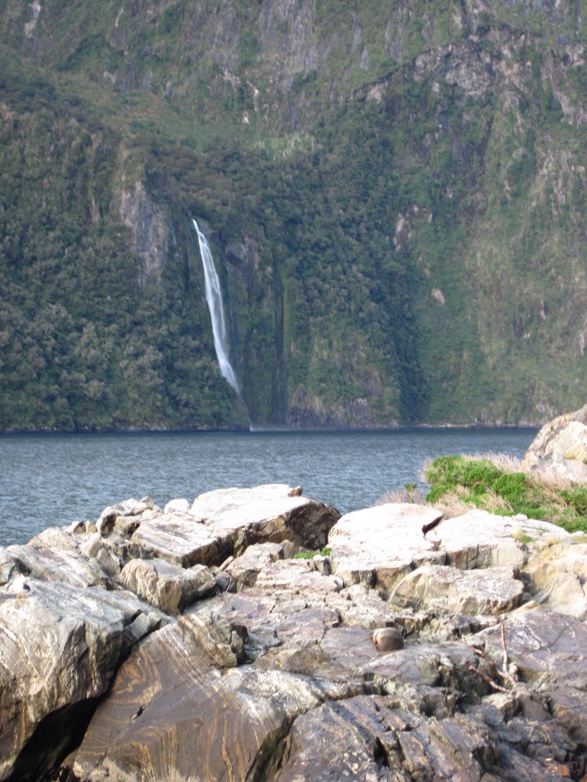
So. This blog wasn't as good as the one I'd already written, which is annoying. To make up for it, here are a few more pics of Milford Sound for you:



The West Coast II - Big Adventure Day 6

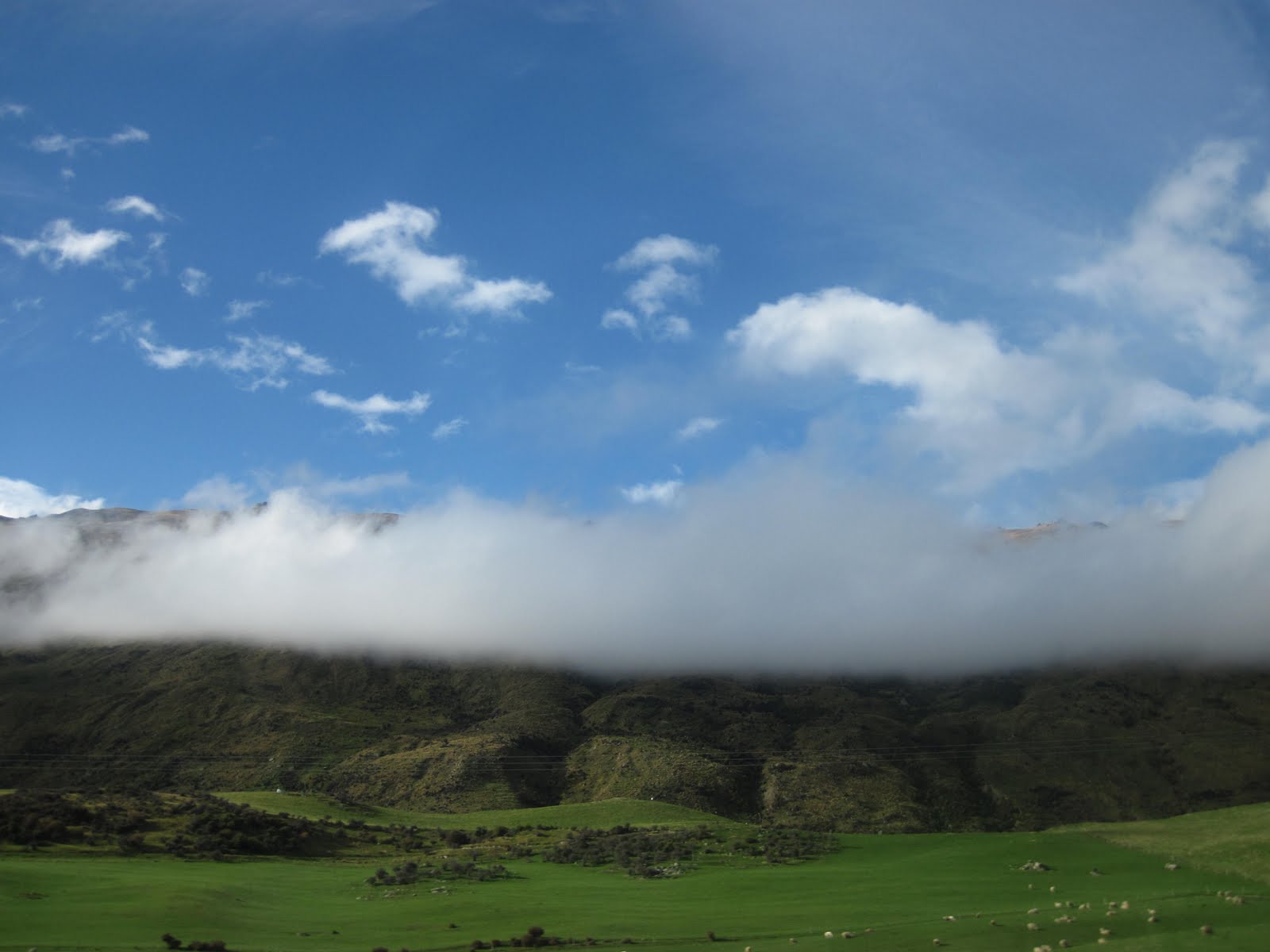
The journey from Franz Josef to Queenstown was another stunning West Coast drive. However, the weather was less kind to us that day, and so we were unable to see a lot of it due to clouds:
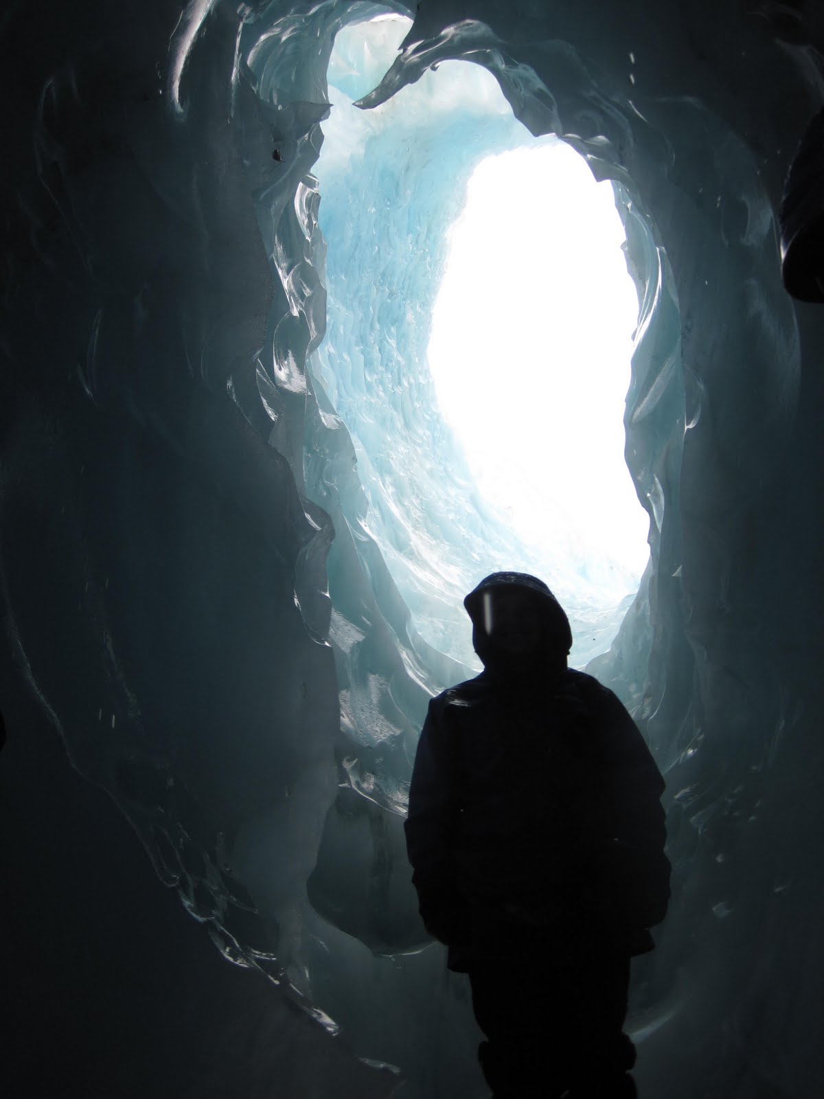


As it was a winding mountain journey again, we were up very high, so we were actually above or inside the clouds at some points:


There was also a lot of rain, so we only got out once to take photos of 'The Gates of Haast'.


Well, with a name like that you have to, really.


Tuesday, 10 May 2011

Franz Josef Glacier - Big Adventure Day 5

The Franz Josef Glacier was named by the German explorer Julius von Haast, who named it after the Austrian Emporer Franz Josef I. The Maori's call it Ka Roimata o Hinehukatere ('The tears of Hinehukatere'). Hinehukatere loved climbing mountains and persuaded her lover,
Wawe, to go with her. However, Wawe wasn't a very good climber, and an avalanche swept him to his death. Hinehuketere was broken-hearted and her many tears flowed down the mountain and formed the glacier.

While this is a lovely story, I find the actual reason for there being a glacier more interesting.

The South Island of New Zealand is actually formed from two techtonic plates; the Indo-Australian plate to the west and the Pacific plate to the east. Where these two plates are colliding, at the Alpine Fault, huge mountains have been thrown up. These are the Southern Alps. It explains why there is so much earthquake activity in New Zealand, and why New Zealand gets about 3cm closer to Australia every year (much to the New Zealander's distress).

When evaporated water in the air moves up and over mountains, it gets colder, condenses, and falls to the ground as snow. Because New Zealand lies in the Roaring Forties, as well as the El-Nino weather pattern, it gets a lot of warm air carrying an awful lot of water hitting the West Coast. As a result Franz Josef gets approximately three times as much snow as other glaciers worldwide.

When snow falls on the top of the mountain, the pressure and temperature causes it to freeze into blue ice, and hence creates a glacier. The glacier originally began in an ice age, and extended all the way out to the Tasmanian Sea on the coast 15,000 years ago. Nowadays the terminal face (end bit of the glacier) is about 19km away from the sea, though the glacier is advancing and retreating all the time. The movement of the glacier depends on the balance between the amount of snow falling on the neve (the top) and the amount of meltwater coming from the terminal face. At the moment Franz Joseph is advancing, at times up to 70cm a day - phenomenal speed in glacier terms. It also flows 10 times faster than most glaciers.

Another unusal aspect about Franz Josef is it is one of only three glaciers in the world to extend into a rainforest (one of the others, Fox Glacier, is just down the road, and the other is in South America).

Glaciers tend to be rather cold, funnily enough, so before we were allowed to set off on our day we were given lots of special clothes by the glacier guides. This included: rain jacket, waterproof trousers, hat, gloves, special boots, and a bumbag containing crampons (slip-on devices with big metal points to provide traction when walking on the ice).

After suiting up we got a bus to the rainforest, and walked half an hour through to the glacier. This is what our first look at it was like:


From where I was stood, the terminal face looked to be about 200-300m away. However, it is very difficult to appreciate any sense of scale when faced with something so massive, and it was actually a 2.3km walk from there to the start of the glacier.

However, the start of the glacier didn't mean the start of walking on ice. Oh no. First we had a half an hour climb up a massive pile of rocks called the terminal moraine.

Moraine is an accumulation of rocks created by glacier activity. As a glacier flows through a valley it chips off rocks and boulders from the bottom and sides of the valley and, like a big conveyor belt, some of these rocks end up at the front of the glacier, being pushed down the valley. This is called terminal moraine. It can be used to see where a glacier has been in the past - indeed we saw some giant piles of rocks some kilometres away from the current terminal face.

There are many other types of moraine. Medial moraine lies on top the glacier, like so (in the foreground):


Lateral moraine is found on either side of the glacier, and can result in huge boulders ending up at the tops of mountains and things, where they have no business being. It can also result in boulders impacted into the sides of the valley, like these two we saw during our time on the ice:


After finally clambering up the terminal moraine we fitted our crampons onto our boots and took our first tentative steps on the ice. Turns out, there is no need to be tentative - the crampons do their job quite effectively and as long as you put your feet down heavily you will not slip at all.

The climb up the glacier was at times quite hard. First thing in the morning (and it really is first thing - our day started at 8:30am and they had already done this) the glacier guides go out onto the ice with chainsaws and create the path for us to climb. They have to do this every day, because within the space of a few hours any steps or paths created will have either melted away or broken up into huge crevasses as the glacier flows down the valley (currently flowing at about 3m per day - super speedy). Even as we were climbing they had to revise the path constantly because it changed so fast. Here is our glacier guide creating a step with his pick-axe:


Here are some pictures of the glacier:


It was surprising how blue it was. It was also surprising how wet the glacier was. I know that sounds weird, but I had envisaged glaciers as just big blocks of solid ice. However the water is constantly melting, and all over the glacier there were little streams and waterfalls within the glacier itself, running in tunnels beneath our feet.

After a good few hours squeezing through tight crevasses and hauling ourselves up steep steps carved into the ice, we stopped for lunch. Here is a diagram of the glacier:


Yep, after four hours of climbing, that was how far we'd travelled. Not very far at all.

After lunch the guides took us to two features in the ice. The first was a big bridge of ice, that was unusual in that it had been around for a whole month. Normally something like that would only last a few days. Unfortunately, however, this meant we couldn't walk under it as at any moment it was going to collapse, and hundreds of tons of ice would fall down. Our guide said if it didn't fall within the next couple of days they may have to chop it down because it will only become more hazardous.


Unfortunately our guide took that picture, and while may be handy with a pick-axe, he's not very good at photography.

After the ice bridge we went to an ice cave that had appeared overnight, then set off back down the glacier. This took much less time than going up, and some of it felt a bit more like deliberate falling than walking. At one point DrE broke both her crampons, so I got to play around with the guide's pick-axe while he fixed them:


That was fun.

After climbing back down, re-clambering over the terminal moraine, and trekking back through the rainforest, we handed back all our equipment and went to the complementary hot springs.

Yep, I know. Glacier. Hot springs. In the same place. Mind-boggling.

New Zealand is weird.

Monday, 9 May 2011

The West Coast - Big Adventure Day 4

The morning of day 4 had been put aside for something to do in Greymouth, as it wasn't a long drive to our next stop. However, we had seriously overestimated Greymouth - there isn't anything to do. Instead we went to a local greenstone shop.

As I already mentioned greenstone (pounamu), is a type of jade found exclusively on the west coast of the South Island, and is highly prized by the Maori people, for many reasons. Firstly, greenstone has a natural 'grain'. This makes it extremely hard and durable it pressure is applied against the grain, but it can be broken and shaped if pressure is applied with the grain. As the Maori people did not have metal before the arrival of Europeans, greenstone was used to make their finest tools. To cut it a paste was made with crystals from sandstone, some of which are harder than greenstone, and rubbed into the stone using a piece of material.

Secondly, when polished greenstone is very beautiful, and can come in different shades and patterns. It was used to make jewelery, such as a figure called hei tiki, which is believed to hold the power (mana) of previous owners. It is believed that mana is absorbed into the stone and so the jewelery carries a piece of the wearer in them. Therefore it is customary for people to wear the jewelery for a period before giving it as a gift.

The greenstone shop we went to is owned by a guy called Garth, who when we arrived was being filmed for a French documentary. He was also wearing very small shorts.

Garth is the great great great grandson of the famous chief of the Ngati Mahaki tribe, Te Koeti Turanga. The Ngati Mahaki tribe are the only people in New Zealand who have the right to collect greenstone from the West Coast rivers and mountains. Because of this 90% of greenstone in New Zealand shops is imported, and so not actually pounamu. It is important, therefore, when buying greenstone, you only get buy it from a member of the Ngati Mahaki tribe.

Garth was very helpful and educated us all about the history of greenstone and what the meanings of each of the pieces of jewelery we were buying. As Maori tradition dictates, he rubbed each stone between his fingers, so warming the stone and putting some of his mana into the jewelery. So, all wearing very similar necklaces and looking super-touristy, we set back off on our escape from Greymouth.

We'd heard the drive down the West Coast was stunning, and boy, it was. The weather was cloudy and we had a few showers, but that didn't stop us from appreciating the scenery. We stopped for lunch at the very serene Lake Ianthe:


Unfortunately, we'd forgotten that West Coast lake/river = midgies/sandflies. So the rest of the journey mainly involved periodically swatting parts of the car or our anatomy to rid ourselves of our sudden fly infestation. We arrived only marginally bitten at Franz Josef Township mid-afternoon, and got ourselves ready for the next days activites: climbing a glacier.

Yep. An actual glacier.

More to come soon!